


Riverside Voting District, Pinal County, Arizona
About
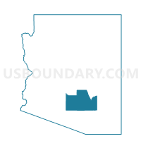
Outline

Summary
| Unique Area Identifier | 525606 |
| Name | Riverside Voting District |
| County | Pinal County |
| State | Arizona |
| Area (square miles) | 125.80 |
| Land Area (square miles) | 125.30 |
| Water Area (square miles) | 0.50 |
| % of Land Area | 99.60 |
| % of Water Area | 0.40 |
| Latitude of the Internal Point | 33.05812470 |
| Longtitude of the Internal Point | -110.96510900 |
Maps


Graphs
Select a template below for downloading or customizing gragh for Riverside Voting District, Pinal County, Arizona


Neighbors
Neighoring Voting District (by Name) Neighboring Voting District on the Map
- Cactus Forest Voting District, Pinal County, AZ
- Dudleyville Voting District, Pinal County, AZ
- Florence N Voting District, Pinal County, AZ
- Kearny Voting District, Pinal County, AZ
- Kearny Rural Voting District, Pinal County, AZ
- Superior S Voting District, Pinal County, AZ
Top 10 Neighboring County Subdivision (by Population) Neighboring County Subdivision on the Map
- North Pinal CCD, Pinal County, AZ (152,330)
- Florence CCD, Pinal County, AZ (34,685)
- San Manuel CCD, Pinal County, AZ (20,418)
Top 10 Neighboring Place (by Population) Neighboring Place on the Map
Top 10 Neighboring Unified School District (by Population) Neighboring Unified School District on the Map
- Florence Unified School District, AZ (70,940)
- Ray Unified District, AZ (3,826)
- Superior Unified School District, AZ (3,364)
Top 10 Neighboring State Legislative District Lower Chamber (by Population) Neighboring State Legislative District Lower Chamber on the Map
Top 10 Neighboring State Legislative District Upper Chamber (by Population) Neighboring State Legislative District Upper Chamber on the Map
Top 10 Neighboring 111th Congressional District (by Population) Neighboring 111th Congressional District on the Map
Top 10 Neighboring Census Tract (by Population) Neighboring Census Tract on the Map
- Census Tract 8.03, Pinal County, AZ (12,149)
- Census Tract 22, Pinal County, AZ (5,250)
- Census Tract 23, Pinal County, AZ (2,420)